Mapping Mars: Scientists Reveal Stunning Global Surface Map with Unprecedented Detail

Scientists have stitched together 110,000 individual images taken by NASA's Mars Reconnaissance Orbiter (MRO) to create a 5.7 trillion pixel global surface map of Mars. It took six years of effort to realize the map. Caltech's Bruce Murray Laboratory for Planetary Visualization has put an interactive version of the map online.
Only 0.5 percent of the Martian surface is not mapped, which is left out due to the lack of images of sufficient resolution or any images at all. The highest resolution global map of Mars previously available was 100 meters per pixel, while the new map offers a resolution of five meters per pixel.
The project was conceived and spearheaded by Jay Dixon, who says, “I wanted something that was accessible to everyone and seamless. School children can now use this. My mother who just turned 78 can use this now. The goal is to lower the barriers for people interested in exploring Mars. I worked on this for six years, but the MRO team has spent the last few decades making this possible in the first place. And the spacecraft is still doing great science."
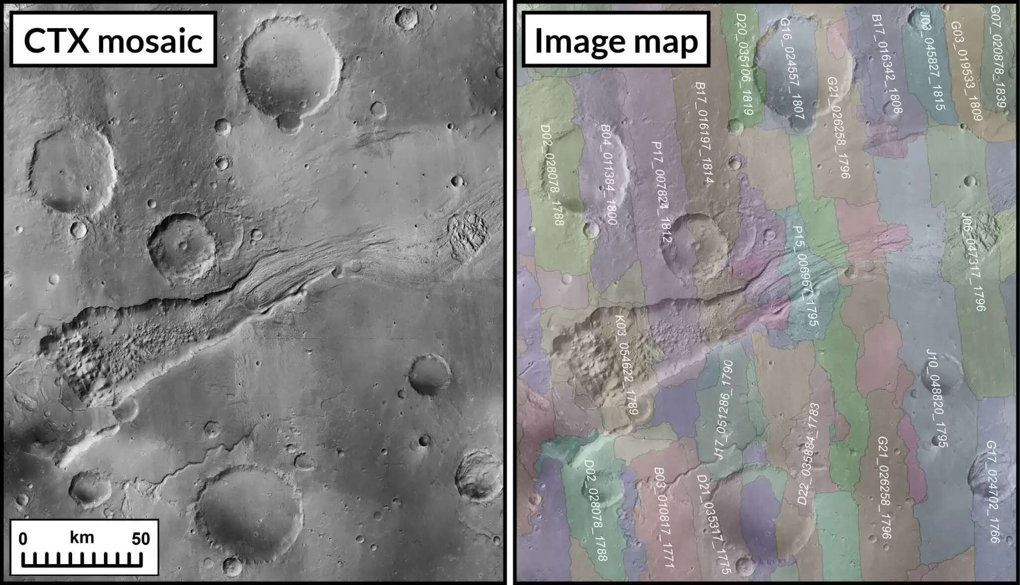
An algorithm was developed to automatically stitch the images together after matching features. Clouds in the atmosphere and dust storms on Mars obscured some features, preventing the algorithm from stitching all the images together. The algorithm couldn't put together nearly 13,000 images, which were manually stitched together, a labor-intensive process that took three years.
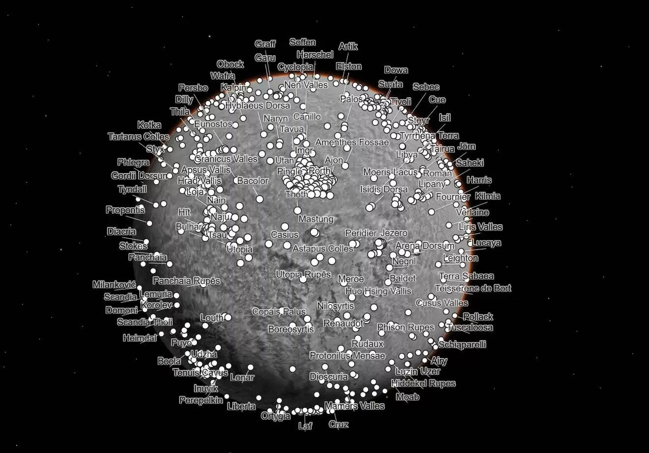
An interactive interface on the visualization allows users to navigate to points of interest on the Red Planet, including Gale Crater discovered by Curiosity and Jezero Crater studied by Perseverance. With individual images used to create an image mosaic, each pixel in the visualization can be traced back to the original image.